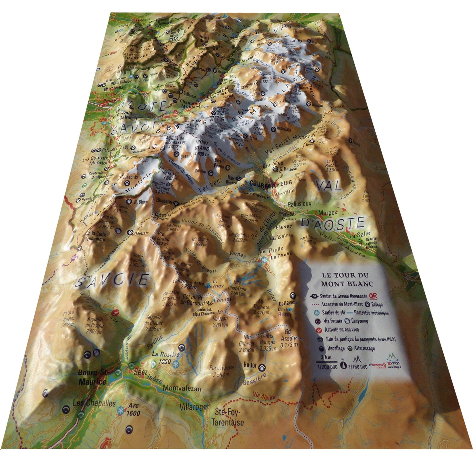
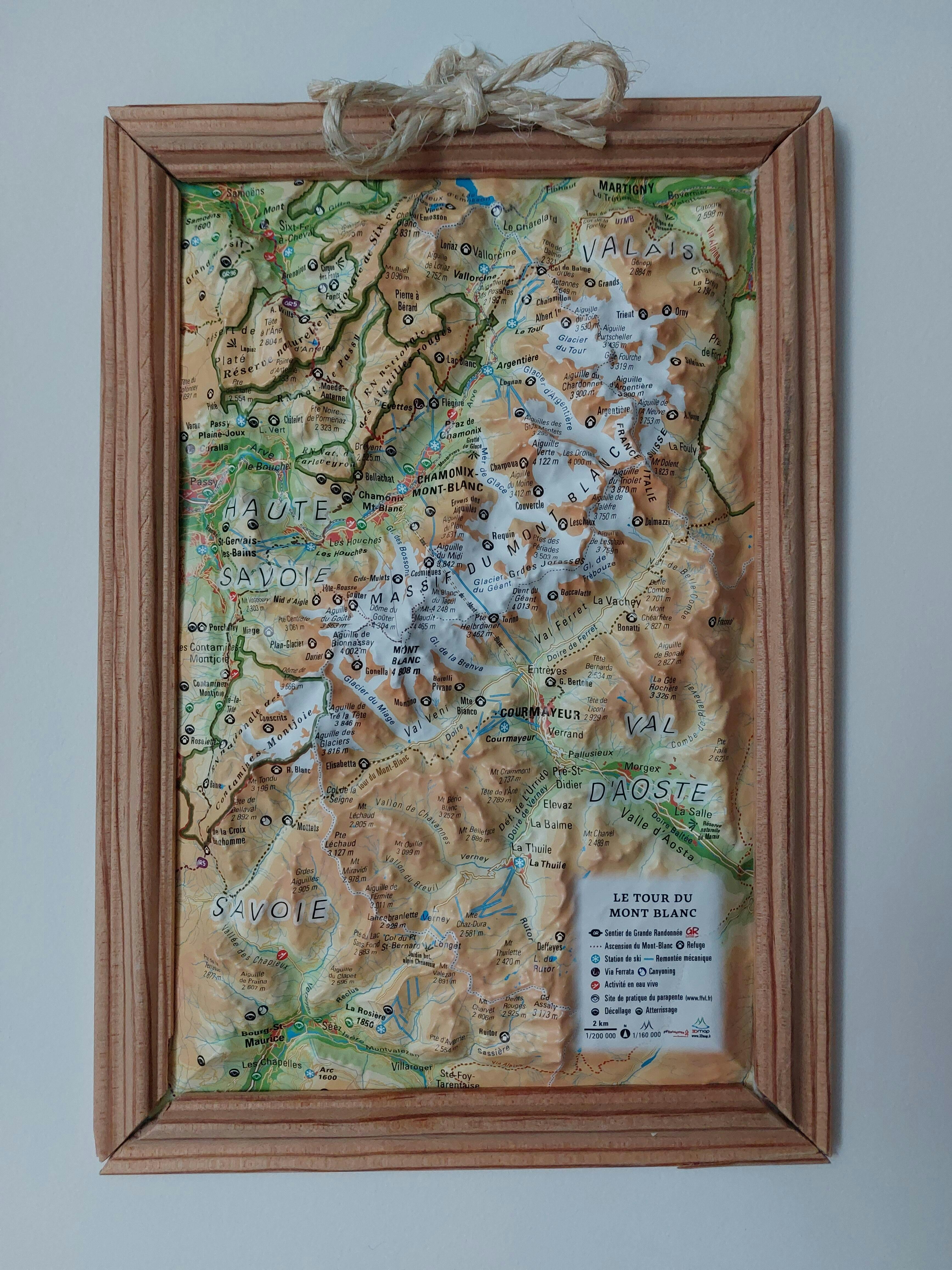
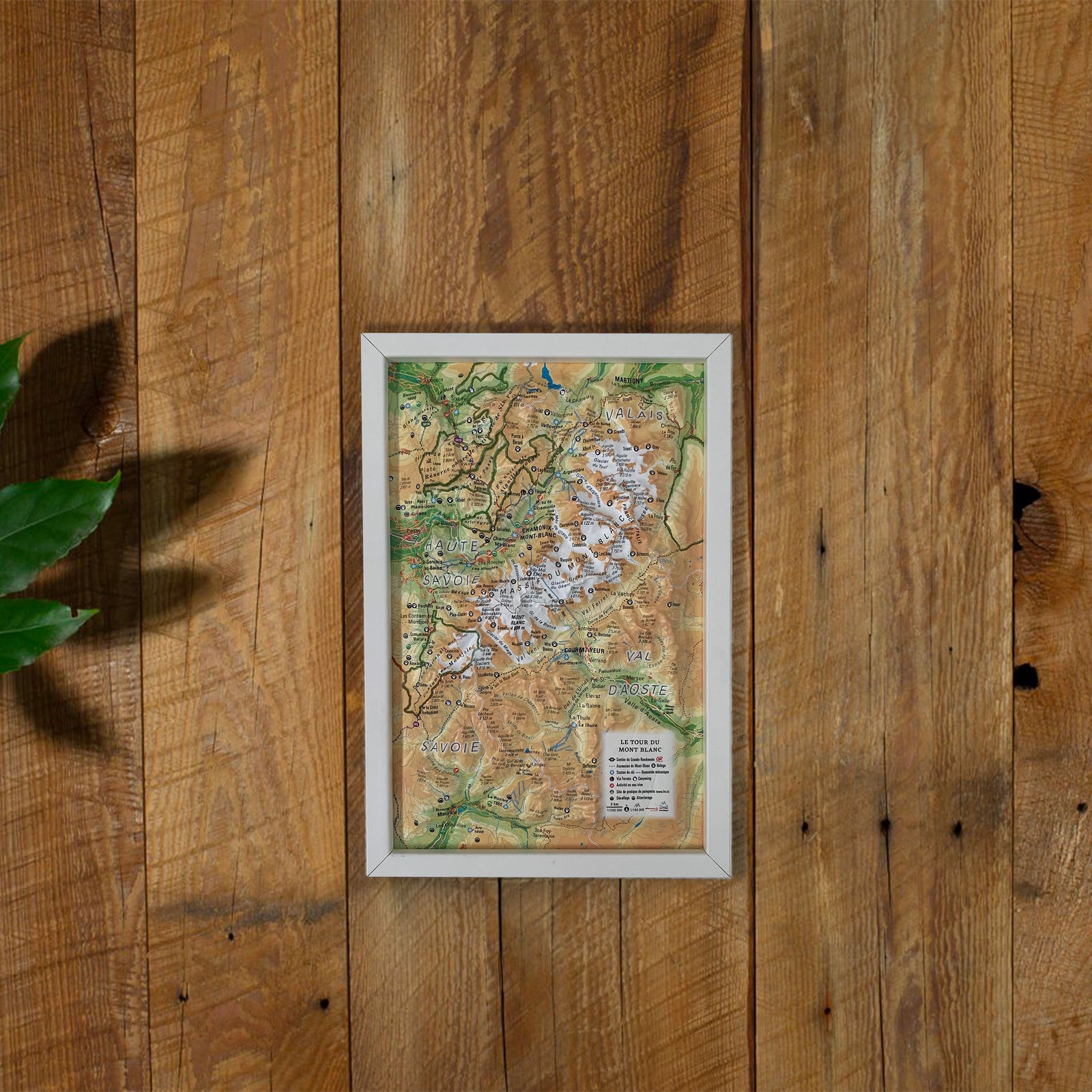
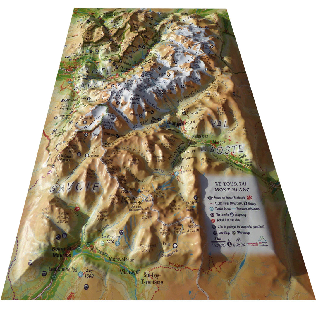
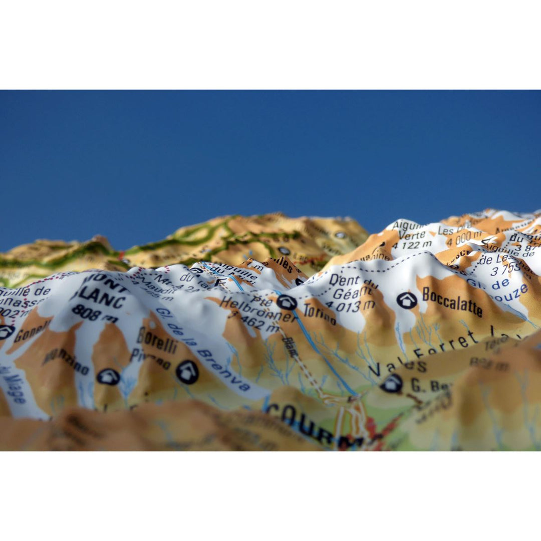
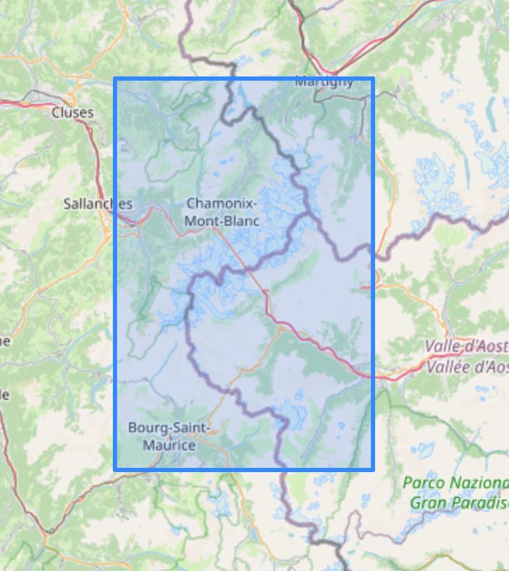
3D Raised relief map - Mont Blanc Tour (19.5 cm x 29.5 cm) | 3D Map (French)
- Shipping within 24 working hours from our warehouse in France
 
- Delivery costs calculated instantly in the basket
 
- Free returns (*)
 
- Real-time inventory
 
- In stock, ready to ship
 
Over 19,500 maps 🗺️ and travel guides, hiking maps, posters, globes, and decor in stock!
MapsCompany becomes Cartovia ✨ We tell you everything here 🗺️
Trusted by map lovers and explorers 🌏 in 80+ countries since 2010 ✅
Relief wall map that covers the Tour of Mont Blanc.
A finishing frame is also available as an option: We highly recommend it to make hanging easier and to enhance the appearance of your map.
   
Information included on the map: 
 - General data: 
 • Hydrological, natural and hypsometric data - Administrative data 
 • Glaciers, vertices, rocks 
 
 - Sports sites, Hiking: 
 • Ascension of Mont Blanc 
 • Large hiking trails 
 • Refuge and cottage 
 • Canyoning sites • Ski lift 
 • Belvédères, Orientation Tables < BR> • Ski Resorts 
 • Live Water Activity 
 • Paragliding Practice Sites (www.ffvl.com) 
 • Takeoffs, Landings 
 • Airports, Aerodromes 
 
 - Scale & Dimensions: 
 • Planimetric Scale: 1: 200 000 
 • Altimetry Scale: 1: 120,000 
 • 19.5 cm x 29.5 cm 


                            	ISBN/EAN : 9791097206246


                        Publication date: 2020


                        Scale: 1/200,000 (1cm=2km)


                        Unfolded dimensions: 19.5cm x 29.5cm


                        Language(s): French


                            	Weight: 
                  				
                  					32 g 


Having recently completed the TMB with my son I purchased two of these as a momento to remember the adventure. I was delighted with the quality and have mine mounted on the wall at home along with pictures of the trip.
suffisamment bien pour l'usage que je veux en faire
Petit format, carte bien faite avec le tracé classique du tour du Mont Blanc ( sans les variantes ). Joli souvenir du trek.
On peut bien voir le trajet du tour du mont blanc grâce à cette carte
The exclusive newsletter for travel and discovery enthusiasts!